
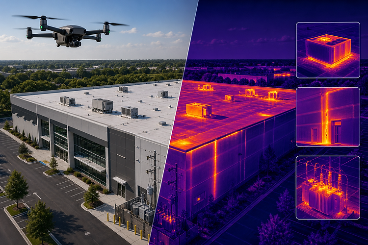
INFRASTRUCTURE & BUILDING INSPECTIONS
Safer inspection support for roofs, facades, structures, and hard-to-reach assets.
Lance Geospatial Solutions provides high-resolution aerial inspection imagery and visual documentation to help property owners, facility managers, contractors, and project teams evaluate existing conditions safely and efficiently.
ROOFS
Document roof conditions, drainage areas, access points, and visible damage from above.
FACADES
Capture exterior walls, elevations, windows, cladding, and hard-to-reach building details.
INFRASTRUCTURE
Inspect towers, utilities, site assets, and exterior structures with clear aerial imagery.
THERMAL
Use thermal imagery support for roof evaluation, moisture concerns, and facility condition review.
Roof
Inspections
Capture detailed aerial imagery of roof surfaces, drainage areas, penetrations, visible wear, and storm-related conditions without unnecessary roof access.
Facade & Exterior Documentation
Document exterior walls, elevations, windows, cladding, and hard-to-access building areas with clear inspection-focused visuals.
Infrastructure & Asset Review
Support review of towers, utilities, site assets, structures, and exterior infrastructure with organized aerial documentation.